Showing results 171 to 180 of 2073 for “oil map”

TC Energy is one of North America’s leading energy infrastructure companies with operations in natural gas, oil and power industries.
TransCanada Corporation today launched an open season to solicit binding commitments from interested parties for transportation services of crude oil from Cushing, Oklahoma to markets on the U.S. Gulf Coast on incremental capacity on Marketlink.

CALGARY, ALBERTA--(Marketwired - July 20, 2015) - TransCanada Corporation (TSX:TRP)(NYSE:TRP) (TransCanada) today announced it has safely delivered the one billionth barrel of Canadian and U.S. crude oil on the Keystone Pipeline System, contributing to U.S. energy security and genera...
A natural gas pipeline that will stretch 287 km (178 miles) from end to end, the Tula Pipeline Project will safely deliver fuel from Tuxpan, Veracruz, to communities in the states of Puebla and Hidalgo.
The map depicts the pipeline locations for NGTL Pipeline System in northern Alberta.
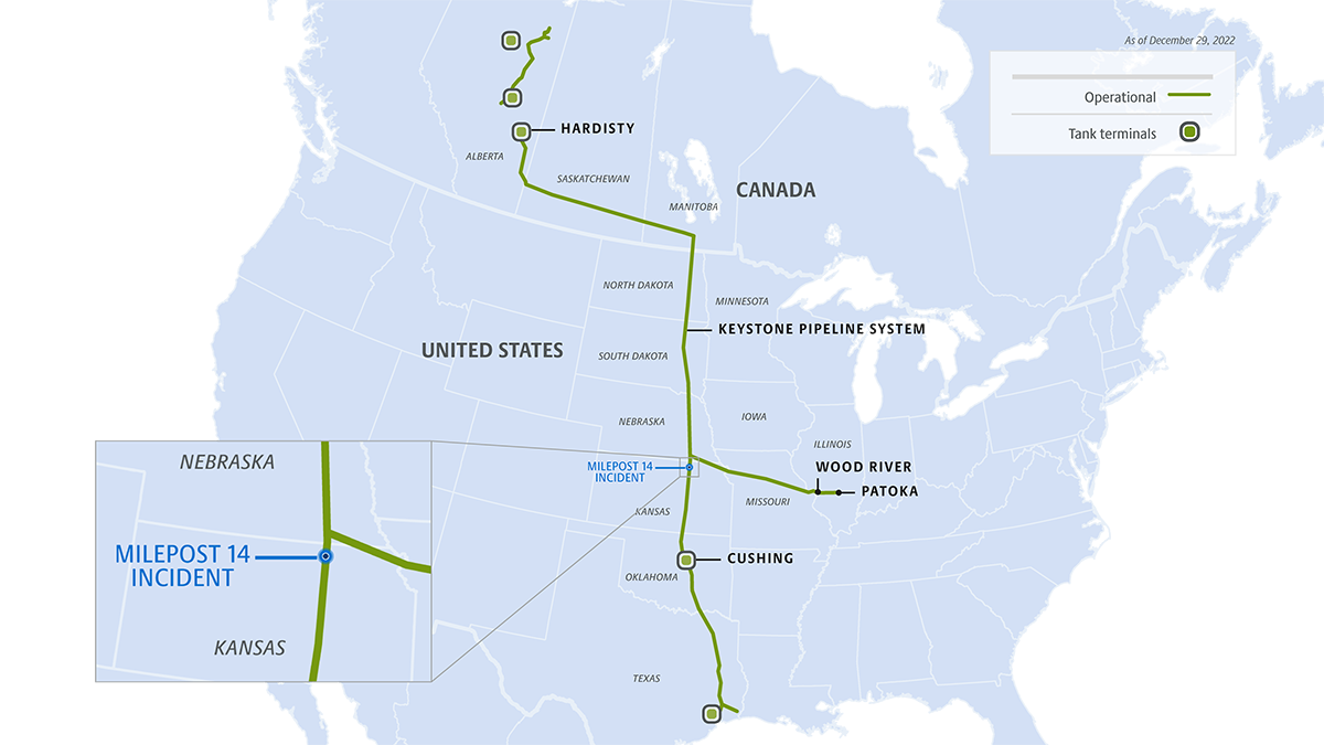
This week, TC Energy completed in-creek recovery of the released volume and continues progressing restoration activities.
Spanning more than 420 km (261 miles) from Tula, Hidalgo, and ends in Villa de Reyes, San Luis Potosí, the completed Villa de Reyes Pipeline will transport natural gas to power generation facilities in Central Mexico.
2024 Abandonment Program - Program Update
Spanning more than 420 km (261 miles), the completed Villa de Reyes Pipeline will transport natural gas to facilities in Central Mexico.
Prince Rupert Gas Transmission is a proposed 900 km (559 mile) pipeline that will deliver natural gas from a point near Hudson’s Hope to the Pacific NorthWest LNG Facility near Prince Rupert, B.C., Canada.